Resource
What is the Cana-Woodford Basin?
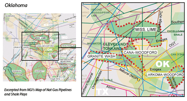
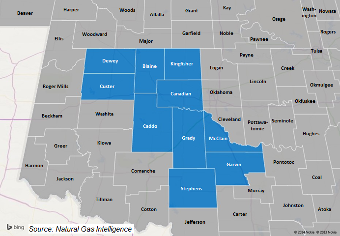
The Cana-Woodford (also known as the Anadarko-Woodford) is a liquids rich shale formation that is named after Canadian County, OK, although the formation underlies several counties in the western half of the state. Production in the Cana-Woodford kicked off in the 1930s from conventional vertical wells, with the industry’s first horizontal well coming in 2007. More recently, however, the counties that comprise the Cana fairway have been targeted for emerging oil plays, such as the SCOOP and STACK formations.
The Cana is a relatively deep formation, ranging from 8,000′-16,000′ in true vertical depth, with some wells reaching total measured depth greater than 20,000′. In 2011, the U.S. Energy Administration went so far as to declare the Cana-Woodford the deepest commercial horizontal shale play in the world. Similar to the Eagle Ford and the Ohio-Utica formations, the Cana features a dry gas, a condensate, and an oil window.
Counties
Oklahoma: Blaine, Caddo, Canadian, Custer, Dewey, Garvin, Grady, Kingfisher, McClain, Stephens