Resource
What is the Mississippian Lime Play?
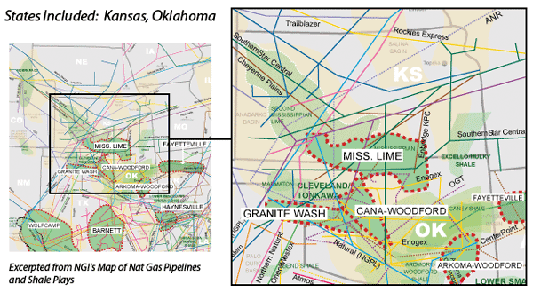
The Mississippian Lime (ML), a carbonate formation that primarily produces oil, underlies a large portion of Northern Oklahoma and Southern Kansas. The formation has been drilled vertically since the 1940s, with its first horizontal well drilled in 2007. The play lies at a fairly shallow depth (4,000-7,000 feet), and it features different drilling characteristics from shale and tight sands formations. Carbonate plays tend to be more permeable, which reduces the amount of drilling horsepower required to navigate through the rock. This, along with its shallower depth, tends to reduce drilling costs, everything else being equal.
Counties
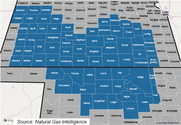
Note: The list and map on the next page include all counties that may be prospective for the Miss Lime, but in reality, horizontal drilling has been focused mostly in Oklahoma counties, with a handful in Kansas along along the KS/OK border.
Kansas: Barber, Butler, Chase, Chautagua, Clark, Coffey, Comanche, Cowley, Dickinson, Edwards, Elk, Finney, Ford, Gove, Grant, Gray, Greenwood, Harper, Harvey, Haskell, Hodgeman, Kearny, Kingman, Kiowa, Lane, Logan, Lyon, Marion, McPherson, Meade, Montgomery, Morris, Ness, Pawnee, Pratt, Reno, Rice, Rush, Saline, Scott, Sedgwick, Seward, Sheridan, Sherman, Stafford, Stevens, Sumner, Thomas, Trego, Wallace, Wichita, Wilson, Woodson
Oklahoma: Alfalfa, Blaine, Creek, Garfield, Grant, Harper, Kay, Kingfisher, Lincoln, Logan, Major, Noble, Osage, Pawnee, Payne, Tulsa, Washington, Woods, Woodward